Olomouc District (Okres Olomouc)
Babice - Bělkovice-Lašťany - Bílá Lhota - Bílsko - Blatec - Bohuňovice - Bouzov - Bukovany - Bystročice - Bystrovany - Červenka - Charváty - Cholina - Daskabát - Dlouhá Loučka - Dolany - Doloplazy - Domašov nad Bystřicí - Domašov u Šternberka - Drahanovice - Dub nad Moravou - Dubčany - Grygov - Haňovice - Hlásnice - Hlubočky - Hlušovice - Hněvotín - Hnojice - Horka nad Moravou - Horní Loděnice - Hraničné Petrovice - Huzová - Jívová - Komárov - Kožušany-Tážaly - Krčmaň - Křelov-Břuchotín - Liboš - Lipina - Lipinka - Litovel - Loučany - Loučka - Luběnice - Luká - Lutín - Lužice - Majetín - Medlov - Měrotín - Mladeč - Mladějovice - Moravský Beroun - Mrsklesy - Mutkov - Náklo - Náměšť na Hané - Norberčany - Nová Hradečná - Olbramice - Olomouc - Paseka - Pňovice - Přáslavice - Příkazy - Řídeč - Samotišky - Senice na Hané - Senička - Skrbeň - Slatinice - Slavětín - Strukov - Střeň - Suchonice - Svésedlice - Štarnov - Štěpánov - Šternberk - Šumvald - Těšetice - Tovéř - Troubelice - Tršice - Újezd - Uničov - Ústín - Velká Bystřice - Velký Týnec - Velký Újezd - Věrovany - Vilémov - Želechovice - Žerotín
Part of the district area belongs to Military Area Libavá.
Map - Olomouc District (Okres Olomouc)
Map


Country - Czech_Republic
 |
 |
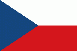
| Flag of the Czech Republic | |
The Duchy of Bohemia was founded in the late 9th century under Great Moravia. It was formally recognized as an Imperial State of the Holy Roman Empire in 1002 and became a kingdom in 1198. Following the Battle of Mohács in 1526, the whole Crown of Bohemia was gradually integrated into the Habsburg monarchy. The Protestant Bohemian Revolt led to the Thirty Years' War. After the Battle of White Mountain, the Habsburgs consolidated their rule. With the dissolution of the Holy Empire in 1806, the Crown lands became part of the Austrian Empire.
Currency / Language
| ISO | Currency | Symbol | Significant figures |
|---|---|---|---|
| CZK | Czech koruna | KÄ | 2 |
| ISO | Language |
|---|---|
| CS | Czech language |
| SK | Slovak language |